Knowing how to navigate in the backcountry is a foundation skill for every hiker and backpacker. Whether you’re sticking to the established trail, plan to beat your own path through the undergrowth, or venture into the open hillside, knowing you’re not going to get lost is pretty reassuring. Navigation goes a lot further than just not getting lost on the trail, though. Basic navigation is useful for planning your trip as well as dealing with any emergency situations that arise while you’re out.
If you’re new to the trails, it can be tempting to leave the navigation in the hands of the grimy old expert who has taken you under their wing. But even the most experienced outdoorsmen make mistakes. Even someone who has spent many years on the trail with command of a map and compass will welcome a second pair of eyes and someone to share the task of navigating. When the time comes for you to go out alone, you’re going to need to know how to keep yourself on track, so here’s our rundown of beginner navigation, the tools you need, and how to use them.
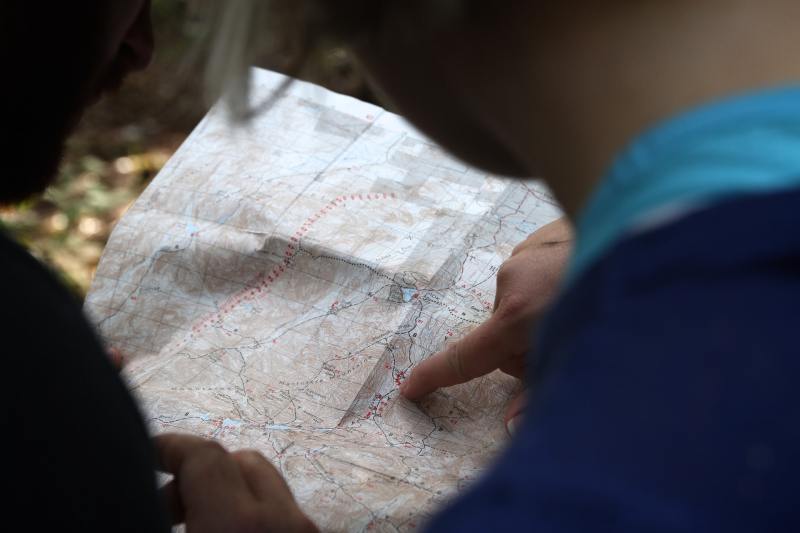
Get a Topographical Map
This bird’s-eye view of the area is key to navigational success. As you spend more time looking at maps, you’ll get a better understanding of how the lines and symbols relate to the ground around you. Before you head out on the trail, spend time learning how to read a topographical map so you understand the symbols and details shown on it. Maps come in different scales and will show varying degrees of information. A smaller-scale map will show more information, but a larger-scale map will fit a wider area on a single sheet.
Eventually, when you look at a map you will build a three-dimensional image in your mind, using contours — lines that connect areas of equal elevation — to build the mountains and valleys of the area. Whether your topographic map shows trails could depend on the scale and location of your map, though most will. These might not be totally accurate, as trails change over time, so you may have to depend on other features and tools to help you navigate.
Learn To Use a Compass
Maps and compasses go together like eggs and bacon, or thru-hikers and body odor. One without the other is unthinkable. A map is only useful if it’s pointing in the right direction — otherwise, it’s an efficient way to walk confidently into the unknown. Having a compass is half the battle, but knowing how to use a compass to orient your map and to take a bearing is essential.
Compasses are always useful, but in poor visibility or on featureless ground, knowing how to follow a bearing is essential. Bearings can stop you from following the wrong ridgeline off a mountain’s peak, or being drawn into following animal trails that lead you off in the wrong direction. Natural instincts are great sometimes, but when it comes to finding your campsite in the dark, a compass is always more trustworthy.

Get Tech-Savvy
A controversial statement, we know. Recommend a GPS to the wrong outdoorsman and you’re in for a lengthy explanation as to why they will never supersede the age-old map and compass. Don’t worry — if you don’t want to use a GPS, we aren’t going to force one into your hands and send you out into the woods. We totally agree that there’s no getting away from a map and compass, and we suggest that anyone using a GPS should also carry these tools and know how to use them as a backup.
But this is 2022 after all. We’re all familiar with using technology to navigate as we drive or explore unfamiliar cities. Whether you use an outdoor specific GPS unit, choose to use your smartphone as a GPS, or download a GPX file onto your navigation watch is up to you. If you’re going to use your smartphone as a GPS, carry a spare or a personal locator beacon, so you can still access help in an emergency.

Practice in a Familiar Place
Whatever tools you choose to use, you need to practice your skills before you head out into the backcountry for real. The best location to practice is one that is familiar enough that you can find your way back, but not so familiar that you won’t even look at the map and compass. An area with obvious features makes for a great starting point, and these can be used to catch any mistakes you might make along the way.
One of the most difficult skills in navigation is pinpointing your exact location when you haven’t been following each and every step you have taken. Start by using large features to locate yourself, like obvious cliffs, trail junctions, or creeks. Once you become more skilled you may find you can use small inlets in the hillside, breaks in the forest, or knolls on the ground to work out your exact location.
Plan Your Hike
If you plan your trip right, half the navigation battle should be complete before you even step out of your front door. Study the map before your trip, get to know the twists and turns of the trail, and give yourself a mental — or physical if it’s easier — checklist of features you will see along the way.
You should always have your map close at hand on a hike, but if your nose is never less than an inch from it, how can you take in the surroundings and enjoy the view? It’s much easier to know that half an hour from the trailhead you will cross a stream, then climb a steep hill, and shortly after you will round a bend and walk alongside a lake for 20 minutes. You should still check your map periodically, but you don’t need to be glued to it.
To work out this mental tick-box, you need to know how long it takes to hike a mile. Work out distances between features and how long each leg of your trip will take you, and use your watch to check them off. Remember, this is only a guide, and your speed will be impacted by steep hills, heavy packs, energy levels, wind, and any other number of factors. But if you expect to see a lake coming up in half an hour and you find yourself by it in five minutes, or vice-versa, something in either your planning or execution has gone wrong.