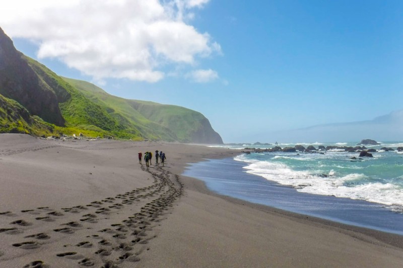
For many backpackers, America’s Triple Crown of Hiking — a title bestowed for completing the Appalachian Trail, the Continental Divide Trail, and the Pacific Crest Trail — is a life-list aspiration. But, beyond the country’s legendary long trails, there are plenty of other iconic treks. From the glacial peaks of the Cascades to the thickly forested foothills of the southern Appalachian Mountains, here are a few of the country’s most spectacular backpacking trips.
The Lost Coast Trail, California
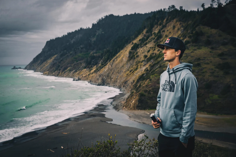
Threading a rugged stretch of coastline devoid of highways, with few signs of human encroachment, northern California’s Lost Coast Trail showcases a region where rugged peaks seem to dissolve into the ocean. The route includes both a 24-mile stretch in the Kings Range National Conservation Area along with a 22-mile section in the Sinkyone Wilderness State Park — but the longer, northern portion is more popular.
Following a route cradled by the Kings Range and the Pacific Ocean, the trail negotiates stretches of coastline pocked with tidal pools and frequented by northern elephant seals. And, between December and April, gray whales migrating between the Baja Peninsula and summer feeding areas in Arctic waters can be spotted offshore.
Greenstone Ridge Trail, Michigan
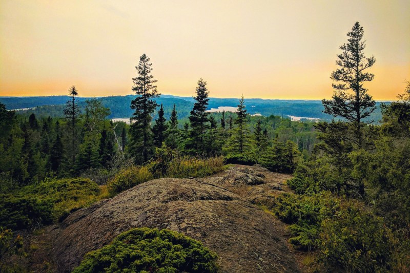
Showcasing one of the most remote national parks in the continental U.S., the Greenstone Ridge Trail traverses the heart of Isle Royale National Park, following the ragged ridgeline that forms the island’s backbone. Along the way, the 42-mile footpath meanders through boreal forests and then skirts moose-browsed lakes and weathered ridgelines, offering photogenic views of Lake Superior.
Backpackers also have the chance to encounter Isle Royale’s most famous residents — the gray wolves believed to have arrived on the island during the winter of 1948, courtesy of an ice bridge that connected the atoll with the Canadian mainland. And, for a few creature comforts, there are lodging options bookending the trail. At the southwestern end of the island, the Rock Harbor Lodge offers cozy camper cabins, and in Rock Harbor at the trail’s northeastern terminus, the lodge features lakeside rooms and self-catering cottages.
Loyalsock Trail, Pennsylvania
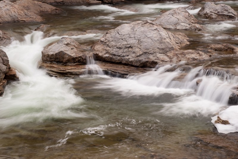
Rambling through northeastern Pennsylvania’s aptly named Endless Mountains region, the Loyalsock Trail is an idyllic East Coast ramble. Situated almost entirely in Pennsylvania’s 115,000-acre Loyalsock State Forest, the 60-mile footpath meanders through mixed hardwood forests of maple and black cherry, passing celestial overlooks, secluded glens, and more than three dozen cascades, including the 80-foot Angel Falls.
Near Highland Lake, a portion of the trail also traces the route of the Sheshequin Path, a regional route first used by the area’s Native American inhabitants and later by troops during the American Revolution and resourceful freedom seekers traveling north along the Underground Railroad.
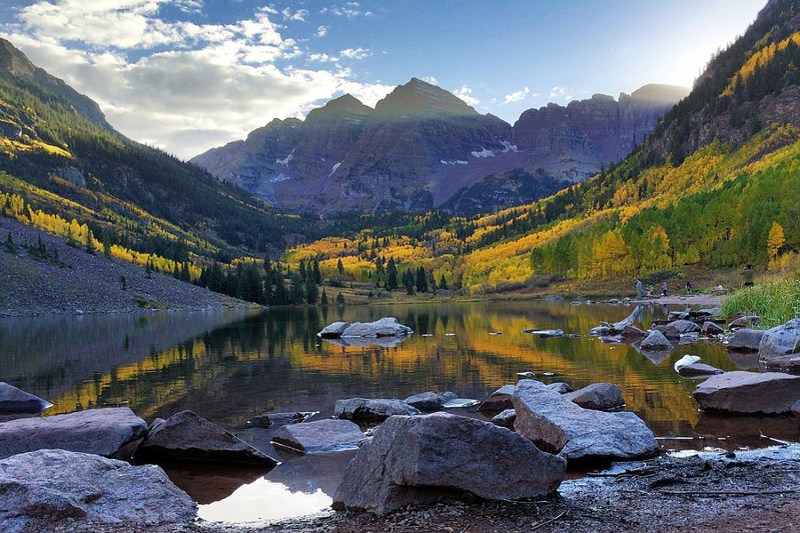
Four Pass Loop, Colorado
Just outside Aspen, in Colorado’s Maroon Bells-Snowmass Wilderness, the Four Pass Loop is a dazzling Elk Mountain sampler, highlighted by the twin peaks of the Maroon Bells — a dream for landscape photographers. Studded with a conglomeration of four different 14,000-foot summits (also known as 14ers), the 27-mile circuit navigates stands of aspen and ponderosa pine, unearthly alpine passes, and glassy lakes, also offering trekkers the chance to spy burly bighorn sheep, mountain goats, and browsing moose. And in the spring, backpackers are also treated to technicolor meadows bursting with blooming aster, columbine, and lupine.
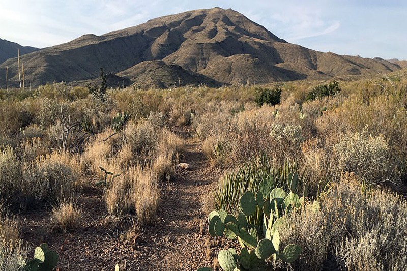
Outer Mountain Loop, Texas
Providing a taste of Big Bend National Park’s diverse natural ecosystems, the 30-mile Outer Mountain Loop rambles from the sun-seared lowlands of the Chihuahuan Desert to the fir and pine woodlands of the Chisos Mountains, along a route adorned with biodiversity-rich canyons, soaring mesas, and the bare-bone remains of old ranches.
Scorching temperatures and shadeless stretches of trail mean the circuit should only be attempted during cooler seasons — and water is always unreliable, so backpackers have to strategically cache provisions for the trek. But, there are plenty of payoffs, too. The protected area is an International Dark Sky Park, and a hotspot for biodiversity, known to harbor more than 400 different bird species.
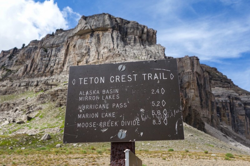
Teton Crest Trail, Wyoming
A high country ramble without any extreme climbs, the Teton Crest Trail showcases a postcard-worthy landscape overshadowed by ragged, sn0w-glazed peaks. Weaving through Grand Teton National Park in northwestern Wyoming, and dipping into the adjacent Jedediah Smith Wilderness and Bridger-Teton National Forest, the trek negotiates mountain passes and unearthly alpine tundra, topping out at 10,700 feet and treating backpackers to an intimate close-up of the rugged granite face of Grand Teton. Beyond the heady landscape, the route also provides ample opportunity to catch a glimpse of the park’s resident megafauna, including moose, elk, and grizzly bears.
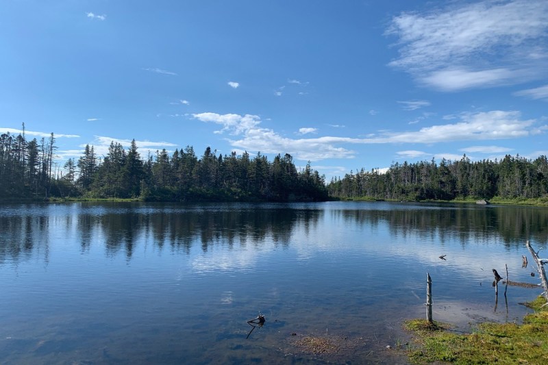
Pemigewasset Loop, New Hampshire
A 31-mile tour of the western corner of the 45,000-acre Pemigewasset Wilderness, the largest wilderness in New Hampshire, the eponymous Pemigewasset Loop serves up some of the most spectacular scenery in New England, along a route studded with eight high peaks. And, with close to 10,000 feet of total elevation gain, the White Mountain circuit features extensive stretches above treeline, including the iconic Franconia Ridge, a knife-edge crest offering a panorama filled with peaks of the Bonds and the Presidentials.
For a break from tent camping, the seasonal Galehead Hut, managed by the Appalachian Mountain Club, is situated near the circuit’s midpoint and offers home-cooked meals and cozy bunkhouse accommodations for backpackers.
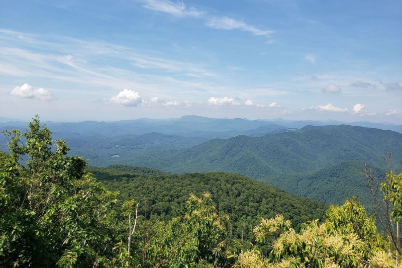
Art Loeb Trail, North Carolina
Named for hiker and local trailblazer Art Loeb, the 30-mile Art Loeb Trail treats backpackers to an exquisite sampling of western North Carolina’s merging mountain ranges. Stretching from the Davidson River to the flanks Cold Mountain, the namesake for Charles Frazier’s 1997 novel, the footpath snakes through the 500,000-acre Pisgah National Forest and the rugged Shining Rock Wilderness. Above the Blue Ridge Parkway, the loftiest portion of the trail strings together four different bald summits, topping out at 6,214-foot Black Balsam Knob and offering expansive views extending to the Great Smoky Mountains.
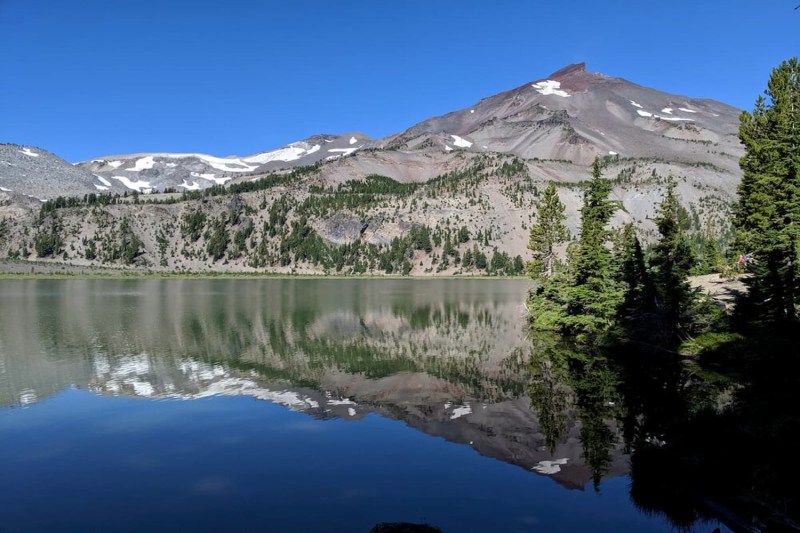
Three Sisters Loop, Oregon
Just outside Bend, Oregon’s Three Sisters Loop treats backpackers to an eyeful of three of the state’s highest peaks — a trio of glacier-glazed stratovolcanos known as the Three Sisters — all rising to elevations above 10,000 feet. The 50-mile circuit circumnavigates a geologically rich swath of the 281,190-acre Three Sisters Wilderness, the second largest wilderness area in the state, garlanding a landscape etched with alpine lakes, unearthly lava fields, and wildflower-flecked meadows.
Portions of the route also follow the path of the Pacific Crest Trail, and traverse the Obsidian Limited Entry Area. And while North Sister is extinct and Middle Sister is dormant, South Sister, the youngest of the trio, remains an active volcano.
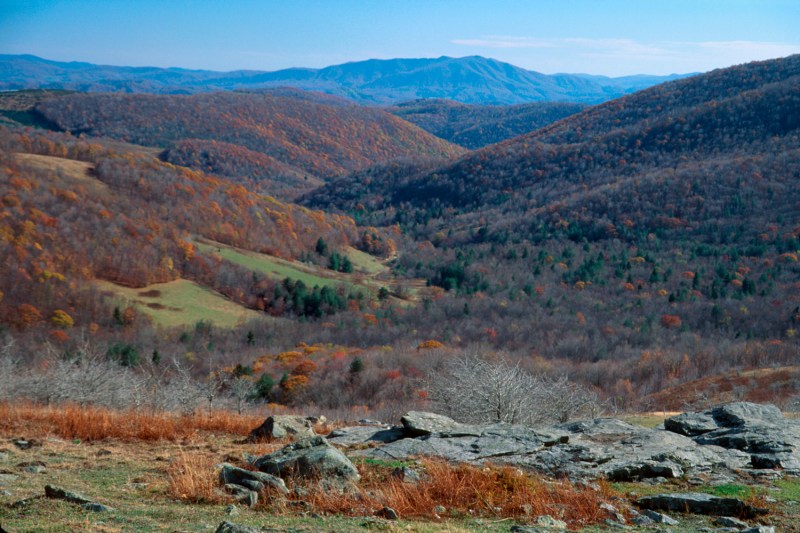
Appalachian Trail through the Mount Rogers National Recreation Area, Virginia
In the Appalachian highlands of southwest Virginia, a 60-mile stretch of the Appalachian Trail rambles through the Mount Rogers National Recreation Area, a 200,000-acre swath of the Jefferson National Forest crowned by the state’s highest peak. Offering a bite-sized portion of Virginia’s 530-mile chunk of the legendary footpath, the 60-mile stretch of trail sluices through the treeless highlands flanking Mount Rogers, traversing alpine meadows grazed by wild ponies, shadowy spruce forests, and icy trout streams.
For a break from the backcountry, the trail weaves through Grayson Highlands State Park just south of 5,729-foot Mount Rogers — and the hiker-friendly town of Damascus is perched on the southwestern edge of the national recreation area.
When is the best time of year to go on backpacking trips?
There are a few factors to consider when deciding the best time of year to go on your backpacking adventures. If you’re backpacking in the U.S., then spring (late April to early June) and fall (September to early November) are considered the best backpacking seasons. Summer can be hot and crowded, while winter brings snow and challenging conditions. However, specific regions might have their own variations.
Here are some additional tips for choosing your backpacking season:
- Research the specific area you plan to visit to understand its unique climate and seasonal variations.
- Check the weather forecast before your trip and be prepared for changing conditions.
- Consider your experience level and choose a season that matches your capabilities.
- Don’t be afraid to be flexible and adjust your plans based on the latest information.


