
These are the 5 best hiking apps for your outdoor adventures

Don't hit the trails without one of these amazing hiking apps

A person holding a phone with the AllTrails maps open.
AllTrails

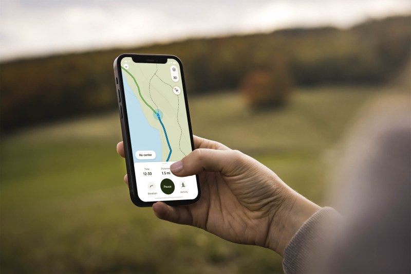
Going on a hiking trip is an exhilarating experience, but before you go, make sure that you have the right tools. Of course, this means wearing the right hiking clothes, packing the right essentials in your backpack, and making sure you have plenty of water, but it also means having the right hiking app on your phone. Part of the appeal of venturing into nature is escaping technology, but we won’t pretend there aren’t ways technology can enhance your experience. There are so many different hiking apps available, so let’s check out some of the best ones on the market. 

Best hiking apps in 2023

AllTrails

AllTrails is undoubtedly one of the best apps for hiking. It offers an extensive range of features to enhance your hiking adventures. With a user-friendly interface, AllTrails allows you to search for hikes based on various criteria such as difficulty, length, elevation gain, route type, and user ratings. You can also discover hikes with specific tags like trail running, dog-friendly paths, or wildflower trails. Download the free version of AllTrails, or subscribe for $2.99 monthly or $35.99 annually.

Learn More

Recommended Videos

Avenza

Avenza Maps is a must-have app for hikers seeking comprehensive map coverage. They claim to have the world’s largest map collection, and they allow you to download maps for offline use. With real GPS positioning, even offline, you can track your location accurately. Additionally, you can record your GPS hikes directly through the app and save photos and notes specific to each location. Avenza Maps also differentiates private land from public land, offering you valuable information about the areas you’re exploring. Download the free version or subscribe for $29.99 per year. 

Learn More

Gaia GPS

Whether you’re discovering new trails, recording your routes, or monitoring hike statistics and performance, Gaia GPS has got you covered. The app even provides weather forecasts and assists you in finding nearby camping options, ensuring you have a seamless outdoor experience. While the free version of Gaia GPS is suitable for most day hikers, the paid version ($35.99 annually) offers additional features. With both topographic and satellite maps, as well as the ability to track your hike with cell service, Gaia GPS is a reliable companion for your hiking expeditions. 

Learn More

Spyglass

Designed for more experienced hikers, Spyglass is a feature-rich app that takes your adventures to the next level. With augmented reality overlay, you can precisely locate points of interest on your hike. Spyglass also offers elevation tracking, a Rangefinder to measure waypoint distances, trail photos, and Tactical GPS functionality, including Civilian and Military coordinate options. However, keep in mind that Spyglass has a slightly steeper learning curve. Purchase for a $5.99 one-time fee.

Learn More

Google Maps

Chances are, you’re already a pro at using Google Maps. Did you know that you can use this platform for your hiking adventures too? Yeah, there’s no need to learn a whole new app. One awesome thing about Google Maps is that it keeps working even when you’re off the grid, as long as you download the maps beforehand. 

In order to download the maps beforehand, make sure the entire trail is visible on your screen. Then, tap your profile icon at the top of the app and scroll down to “Offline Maps.” Tap “Select your own map” and tap “Download.” Google Maps will then start downloading that section. These maps expire, so make sure that you double-check your maps before you do the same trail again.

Whether you’re a novice hiker or an experienced adventurer, these top five hiking apps can revolutionize the way you explore nature’s wonders. Have fun exploring!

Topics
Sarah Joseph
Sarah is a lover of all things outdoors. With a bright sense of adventure and a heart for the mountains, she is always…
Embrace the cold: The best places to camp in the winter
For the best winter camping adventure, try one of these national parks
Yosemite National Park in winter

Winter camping isn't for the faint of heart, but there's no better way to test your adventuring skills. Really, I've found that the only thing you need to do to have an awesome trip is to stay warm. If you can manage that, then winter camping is actually an enjoyable experience. There's nothing better than being a short walk away from some of the best winter sports around. If you're looking for the best places to camp in the winter, there's nowhere better than our beloved national parks.
Yosemite National Park

In my opinion, Yosemite National park is one of the best places for winter camping. If visiting Yosemite during the crowded summer season is not your cup of coffee, you might just enjoy winter camping here instead. There are four campground options that remain open during the winter season. Upper Pines and Camp 4 are both in the Yosemite Valley, so if you're a beginner, these might be decent options due to the slightly milder temperatures. Hodgdon Meadow and Wawona are just forty-five minutes away from the Yosemite Valley, so they are also excellent options.

Read more
Construction at Glacier National Park means changes for your trip — what to know
NPS imposes new rule to manage visitors at Glacier National Parl
The Garden Wall along the Highline Trail in Glacier National Park.

In fall of 2024, the officials at Glacier National Park started a major construction project to replace aging infrastructure. This included the Swiftcurrent area water system, which was originally installed in the 1960s and is in desperate need of replacement. The rehabilitation project also includes road and safety improvements. Since the construction project encroaches on much of the parking options, the National Park Service has announced that personal vehicle access to Many Glacier will be restricted.

Visitors to the park can still enjoy access through a temporary shuttle service that will start operating in July and conclude in September. Otherwise, all vehicles, bikes, and foot traffic will not be permitted until the construction is complete.

Read more
How to use a compass for navigation when GPS fails
Don't get lost this hiking season: try out a compass!
Baseplate compass on top of a map

In the days since GPS was invented, many of us have lost the skill of navigating by a good old compass and map. As a family on the road in a 1991 Airstream Motorhome, we were early adapters to the GPS, but I still remember a time when we had to navigate New York with the crinkled old maps in the glovebox. Out in the wild, things are a little bit different. Milestones don't often sweep you by while you're busy using a magnifying glass to figure out what intersection you're on, but it can still be a challenge. Today, compasses are still considered to be a top 10 safety item by the National Park Service, but it's a shame how many people don't know how to use a compass. Here's how to get started.
Parts of a baseplate compass

There are so many compasses to choose from, but if you're just starting out, I highly recommend using a simple baseplate compass. These are attached to a ruler, so you'll be able to easily take your bearings. Experts from REI do a great job of explaining the basic parts of a compass and how to use them, but here is the breakdown:

Read more