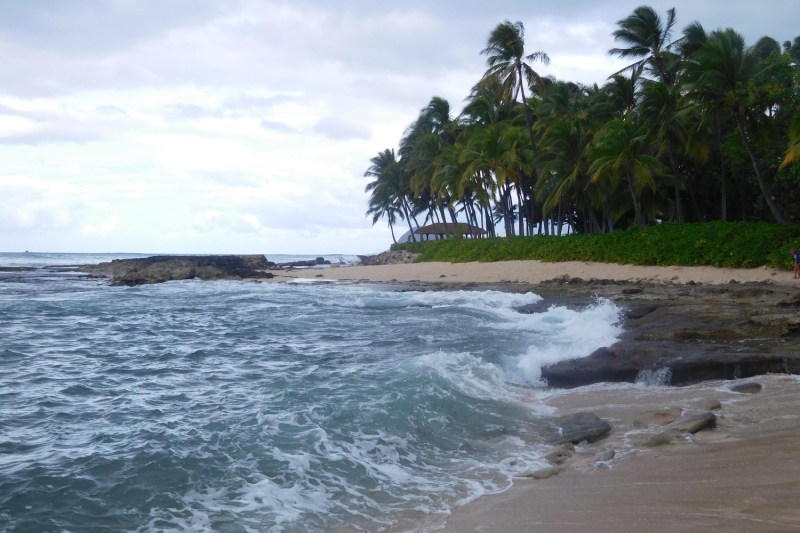
With its 750 miles of total coastline presenting idyllic beaches, clear, warm waters, and some of the best surfing, fishing, diving, and snorkeling spot on Earth, many people associate Hawaii’s opportunities for outdoor recreation with the water. But if you fail to look inland and don’t discover that hiking Hawaii in a golden opportunity, you’re missing out — big time.
Like the biggest mountain on Earth, if you measure Mauna Kea from its base under the ocean to its summit at 13,803 feet above sea level. Like Hi’ilawe Falls, a waterfall with a main drop some 1,200 feet in height. Like miles of perfectly pristine beaches completely devoid of human development.
You can get to the summit of Mauna Kea by car, you can see Hi’ilawe falls by helicopter, and you can reach spots like Kauai’s Kauapea Beach, AKA Secret Beach, by boat, but what ties these and dozens of other spots together? They are best reached by hiking. Sure, surfing is great and all, but Hawaii is just as much of a paradise for the hiker who loves logging miles afoot.
Hiking on Oahu
You will probably fly to Honolulu first, so you might as well get right to it and start your Hawaiian
Diamond Head

Convenient to Honolulu and easy for the fit hiker,
Ka’au Crater
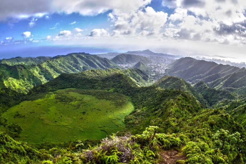
The Ka’au Crater trail is a mere stone’s throw from Honolulu, yet it feels like a world apart. This vigorous day hike will take between four and six hours, depending on fitness levels and pacing, and it’s a great outing for the adventurous folks out there. The trail cuts through dense forest, up steep grades where ropes are tied off to steady you, past brisk streams and waterfalls, and finally into the expansive crater for which the route is named. FYI, you will get muddy, so it might not be a good idea to wear your favorite Hawaiian shirt and board shorts on this hike.
Koko Head
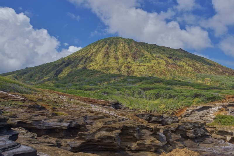
If you’re a glutton for punishment who also enjoys stunning views and only has about an hour to spare, this hike is for you. The route involves nearly 1,050 steps via a disused inclined railway built by the military during World War II. Though only about .7 miles in length, the trail will have your thighs aflame by the time you reach the old army pillbox bunkers at the summit.
Maunawili Trail
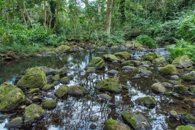
Unlike so many of the hikes on Oahu, this one isn’t short and steep, but long and meandering and challenging only for its distance, not its elevation. The full route is nearly 10 miles one way, so start early and plan to be on the go all day — a better way to spend a day is hard to imagine, of course. The Maunawili Trail is often shaded, offers plenty of open and expansive views as well, and features plenty of water where you can cool off.
Hiking on the Big Island
The island of Hawaii, aka the Big Island, offers superlative trekking, including a ramble up the state high point. Just note that a lot of this massive island is protected land and is off-limits.
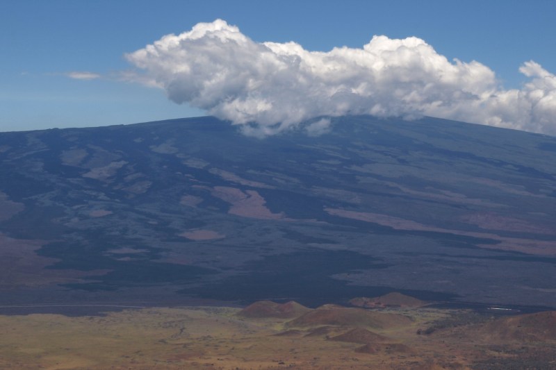
Maunakea

Looming 13,803 feet above sea level, the summit of Maunakea is about as different as the beaches ringing the Big Island could be. Many days out of the year, this Hawaiian peak gets enough snow for skiers to get in runs. And while you can drive all the way to the top of Maunakea, the mountain is better appreciated on foot. The Maunakea Trail (also called the Humuʻula Trail) leads from the Onizuka Center for International Astronomy all the way to the summit of Maunakea. The six-mile trail ascends 9,200 feet vertically, so pace yourself and bring energy foods and lots of water. Fit hikers can do the round trip in less than eight hours.
Pololu Valley
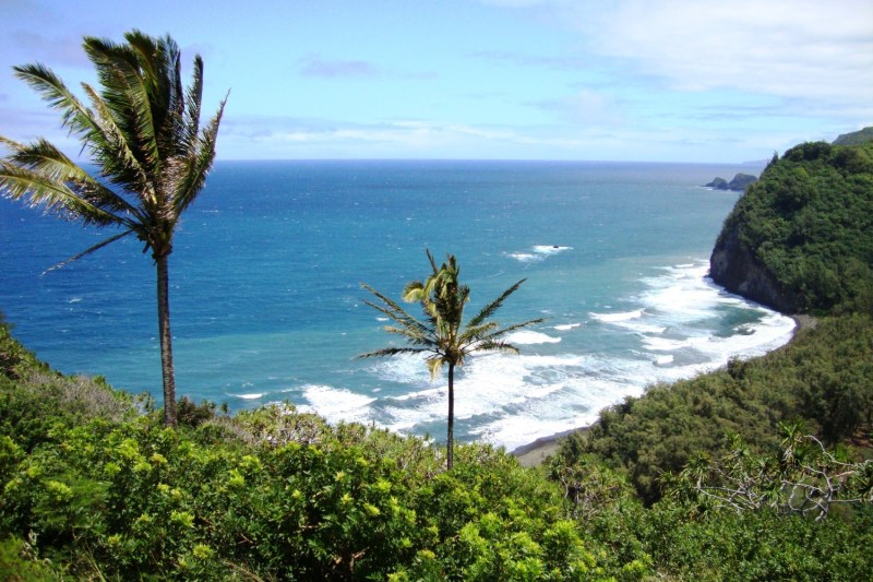
If you only have an hour or two to spare, this two-and-a-half-mile round trip Big Island hike will do. The route leads through the lush Pololu Valley which cuts through verdant forest and steep cliffs. And at the end of the trail, you emerge onto a stunning volcanic black sand beach. Watch for whales.
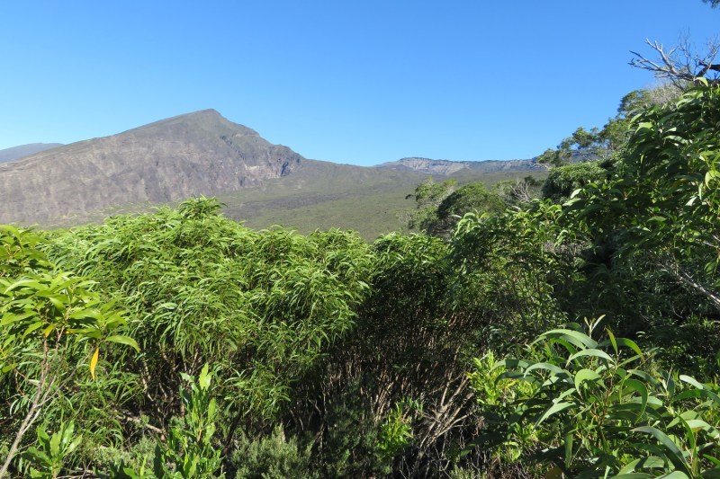
Mauna Loa
For the intrepid hiker, this nearly 40-mile loop could be the day hike challenge of a lifetime. For most folks, it’s a great two-day hike with a one-night campout.
Hiking on Kauai
Kauai is home to plenty of great hikes to the lush interior, but it’s the island’s secluded beaches that offer the best rewards after a good trek.
Kalalau Beach
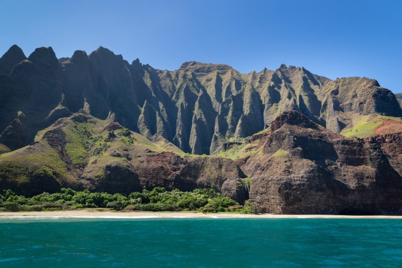
The Kalalau Trail is 11 miles long one way, so plan to spend all day on this trek or even camp out on Kalalau Beach, a stretch of pristine sand that looks all but untouched by humans. The route winds through five valleys and near the edges of many sheer cliffs (not too near…) until finally dropping down to the ocean. If you do plan to camp, make sure you get a permit.
Kauapea Beach
Rather than the 11-mile slog needed to reach Kalalau Beach, you only need to hike about a half mile to reach this secluded beach. You can extend the hike by trekking along a dirt road otherwise used for car traffic, but it’s also a pleasure to stroll along the 3,000-foot stretch of sand also known simply as Secret Beach.
Hiking on Maui
Maui has a few unique gems that make exploring the island on foot the best way to experience it, and that goes for beaches, valleys, and mountains as well.
Kaihalulu Beach

Also, and appropriately named Red Sand Beach, Kaihalulu Beach is one of the few beaches on earth that truly does have red sand, and that alone makes it worth a visit. The cobalt blue water there is almost equally as dramatic. And the hike in to this unique and secluded beach is short but can be challenging, with a few sections presenting significant fall danger to the inexperienced or inattentive hiker.
Kaupo Gap
The trail through the Kaupo Gap starts off with a descent toward the ocean, so save yourself some stamina for the way back through proper pacing. The trail, which is about eight miles one way and sees more than a mile of elevation gain, affords some stunning vistas — you can even see the Big Island on clear days. You will also walk through lush valleys and past towering cliffs, and you can make it a two-day camping trip if you’re in the mood to rough it aloha style.
Tips when hiking the Hawaiian Islands

- Respect the land: Hawaii has a rich cultural heritage and delicate ecosystems. Stay on marked trails, avoid picking plants or flowers, and be mindful of sacred areas.
- Prepare for the weather: Weather can vary greatly depending on the island and elevation. Check forecasts before you go, but be prepared for rain showers or sudden sun exposure. Pack layers, including rain gear and a hat.
- Sun protection is essential: Hawaii’s strong sun can be deceiving. Bring sunscreen with high SPF and reapply throughout the day, especially if you get wet.
- Hydration is key: Dehydration is a real risk. Bring plenty of water and consider a water bladder or insulated bottle to keep it cool. Avoid streams or ponds as a water source unless you have a purifier.
- Early start is ideal: Many trails throughout the islands don’t offer shade, so beat the heat by starting your hikes early in the morning. This is also a good strategy to snag a parking spot at popular locations.
- Sturdy footwear is crucial: Trails can be muddy, slippery, or rocky. Choose proper hiking boots with good ankle support.
- Download maps: While cell service can be spotty, having a downloaded map of the trail on your phone can be a lifesaver if you get turned around.
- Be aware of closures: Trail closures can happen due to weather, maintenance, or cultural significance. Check with park authorities before you head out.
- Enjoy the unique environment: Hawaii’s hikes offer stunning views, volcanic landscapes, and lush rainforests. Keep your eyes peeled for native birds and plants.